Upper Colville River, Alaska
| Map of Northern Alaska | Upper Colville Fossil Images Unassigned | Fossil Images |
|---|
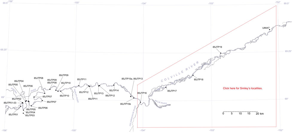
This interactive map of part of the Colville River, Northern Alaska, shows the locations of plant fossil collections made by J.T. Parrish and R.A. Spicer in 1985 and 1989. Click on a number for more details on that site. The red outlined area links to another map showing positions of florules (plant fossil assemblages) collected by C.J. Smiley along both the Colville and Chandler Rivers. |

Locality 89JTP12
Description: The lowermost part of the section consists of rooted cross-bedded sands and siltstones containing ironstone concretions. These contain Podozamites, Pityophyllum, taxodiaceous conifers (e.g. Cephalotaxopsis), ferns, a possible Ginkgo, platanoid angiosperms, pinnately compound angiosperms, large logs and branchwood. Above this is a thin coal containing conifers and Equisetites capped by a rooted siltstone capped by a thin bentonite. Into this siltstone projects an upright tree base. This is overlain by a rooted cross bedded siltstone and sandstone unit with ironstone concretions. Above this are three coals mostly conifer dominated with Podozamites in a carbonaceous shale at the base of the coals. Overlying the coals is a ripple and dune laminated very fine gray sandstone with platanoid leaves.
