Upper Colville River, Alaska
| Map of Northern Alaska | Upper Colville Fossil Images Unassigned | Fossil Images |
|---|
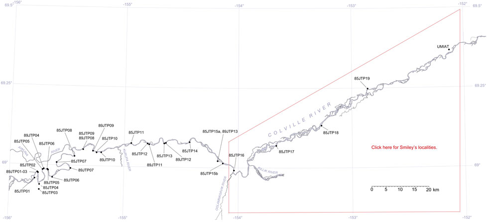
This interactive map of part of the Colville River, Northern Alaska, shows the locations of plant fossil collections made by J.T. Parrish and R.A. Spicer in 1985 and 1989. Click on a number for more details on that site. The red outlined area links to another map showing positions of florules (plant fossil assemblages) collected by C.J. Smiley along both the Colville and Chandler Rivers. |

 |
| Aerial photograph of the 'amphitheater' exposure where locality 89JTP05 is situated at the right hand side of the image. |
