Upper Colville River, Alaska
| Upper Colville Fossil Images Unassigned | Fossil Images 85JTP08 |
|---|
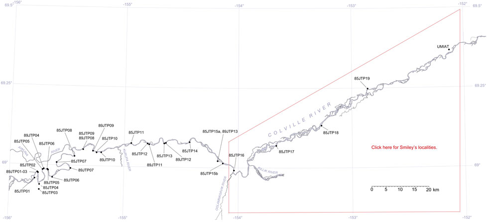
This interactive map of part of the Colville River, Northern Alaska, shows the locations of plant fossil collections made by J.T. Parrish and R.A. Spicer in 1985 and 1989. Click on a number for more details on that site. The red outlined area links to another map showing positions of florules (plant fossil assemblages) collected by C.J. Smiley along both the Colville and Chandler Rivers. |

Locality 85JTP08
This locality is an exposure of the Cenomanian Niakogan Tongue of the Chandler Formation (Chapman et al., 1964), now the upper part of the Nanushuk Formation of Mull et al. (2003). The sediments are predominantly bentonitic clays with siderite nodules, and fine sandstones. The plant fossils are mostly found in the ironstone which occurs both as sheets and nodules, but platanoid leaves occur in the sandstones. The ironstones yield numerous taxodioid conifers, digitate ginkgos, Podozamites, ferns such as Asplenium and Gleichenites, the cycad Nilssonia as well as angiosperms such as Dalembia, Araliaephyllum, Ettingshausenia and some indeterminate monocots. Large pieces of wood, including trunk wood and tree bases are common.
The following a is a summary of the lithologies in the succession logged by J.T.Parrish in July 1985.
| Top of Section | ||
| 0.6 m | Sandstone | |
| 1.5 m | Mudstone | |
| 3 m | Sandstone with abundant logs | |
| 1.8 m | Coaly shale | |
| 2.4 m | Mudstone | |
| 5.5 m | Sandstone | |
| 5.8 m | Gray mudstone, disappears along strike | |
| 0.43 m | Concretionary claystone layer | |
| 0.15 m | Claystone | |
| 0.76 m | Cover | |
| 1.1 m | Muddy siltstone | |
| 0.7 m | Sandstone | |
| 1.4 m | Siltstone and claystone | |
| 0.73 m | Sandstone | |
| 8.8 m | Cover | |
| 1.5 m | Prominant sandstone in the river bed with Equisetites rhizomes |
