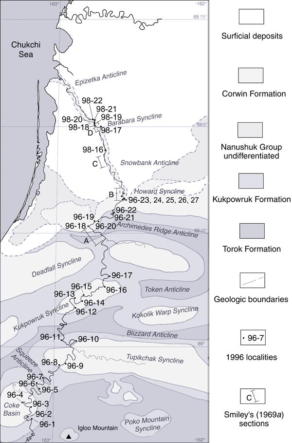
Locality 96-2: 68° 49' 11" N 162° 10' 38" W
Corwin Formation
Specimens: 96 RAS 22, 23, 24, 25
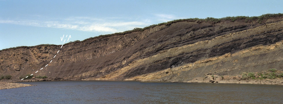
Description. Cut bank forming good exposures (see field photo below).
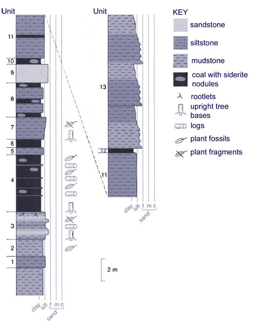
Unit 1. At the base of the exposed section carbonaceous mudstones contain the lowermost reference unit used here which consists of an olive gray indurated siltstone. (1 m thick).
Unit 2. Carbonaceous shale/mudstone, rich in small Podozamites leaves and rare Pityophyllum leaves. (About 1.5 m thick). The basal mudstone, together with units (1) and (2) make up a sedimentary package visually estimated to be at least 10 m thick.
Unit 3. Yellow-weathering gray siltstones and fine sands with a crumbly texture containing abundant Equisetites rhizomes, Podozamites fragments, branch wood and small compressed logs aligned parallel to bedding. Occasional small tree stumps, a few decimetres in diameter, occurred normal to bedding and were rooted in the underlying mudstone. (Approximately 2.5 - 3 m thick).
Unit 4. Poor coal bearing numerous ironstone nodules and thin sandy layers, abundant logs, branchwood, and Podozamites leaves. Pityophyllum is also present but less abundant. (4 - 5 m thick).
Unit 5. Olive gray siltstone containing numerous nodular and sheet form ironstone concretions. (0.7 m thick).
Unit 6. A thin coal within which was rooted a small (approximately 20 cm diameter) upright trunk. (0.7 m thick).
Unit 7. Coarsening upward, yellow/orange weathering gray siltstone rich in Podozamites fragments. (2 m thick). A small tree trunk protruded upwards in to this unit for approximately 1 m.
Unit 8. Succession of three thin (< 0.5 m) poor coals, often with ironstone concretions, separated by olive gray siltstones. (Approximately 3 m thick).
Unit 9. gray, weathering to olive gray/yellow, fine sandstone. (1.5 - 2 m thick).
Unit 10. Poor coal with ironstone nodules (approximately 0.5 m thick).
Unit 11. Olive gray to brown fine silts with a thin, poorly developed coal in the lower third above which there are occasional (up to four) white indurated bands. (8 - 9 m thick).
Unit 12. Thin very poor coal (<0.3 m thick).
Unit 13. Yellow-weathering gray well bedded siltstones and fine sands forming a series of three fining upward cycles. (Estimated to be up to 12 m thick).
At the bend in the river a high angle normal fault (see field photograph below), of unknown throw, had brought down blocky, cross bedded, olive gray siltstones and sandstones rich in Podozamites, Ginkgo ex gr. adiantoides, rare Birisia, Equisetites, Pityophyllum ex gr. staratschinii, and compressed logs. Ginkgo predominated in the sandier beds, while Podozamites was most common in the silts. These beds are moderately contorted and overly, apparently with an erosional contact, underlying yellow/gray sands and silts that dip at approximetely 45° to the west.
Interpretation: Interfluve well-vegetated environments with lacustrine, crevasse splay and mire deposits. Podozamites was largely ubiquitous but particularly abundant in mires subject to some clastic influence. Pityophyllum co-ocurred in the mires but was apparently subordinate to Podozamites. Ginkgo was more frequent in near channel, more disturbed settings.
Below: Field photograph of the Kukpowruk 96-2 section. |


