Kokolik River
| Introduction | Northern Alaska Map | Kokolik Unassigned Fossils | Fossil Images |
|---|
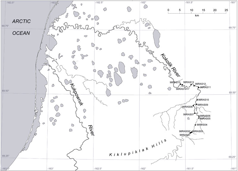
Interactive map of western northern Alaska showing the positions of the plant fossil localities along the Kokolik River. Some specimens are representative of taxa occuring throughout the Kokolik sections and are unassigned. Where specimens are assigned to specific localities the 'Fossil Images' link becomes active. Locality 98RAS05:69.409511°N -161.355816°W |
|
Locality Description:
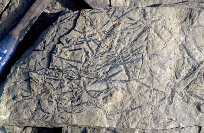
A series of fine sands and coarse silts separated by poorly indurated mud layers approximately 15 cm thick. The sands are are medium gray/light gray, weathering to yellow/orange. The sands contain an abundance of large Pityophyllum leaves associated with Desmiophyllum magnum. Equisetites rhizomes with rare nodulesare also present. Pityophyllum is particulary abundant, randomly oriented on bedding planes. Compressed branch and log wood specimens are also common. On separate bedding planes the small (thin) form of Pityophyllum. This occurs in abundance to the exclusion of other taxa, again with no preferred orientation. Some rooting occurs in the sands. Approximately 300 m upstream possible marine units occur with well developed ripple marks and invertebrate trails.
 |
Pityophyllum leaves randomly orientated on a bedding plane. |

